Loading...
  • VBW Weigt GmbH
    Your key to excellent survey data

38200

Sea miles surveyed

148

Terabyte data analysed

742

Successful projects

Welcome

For 27 years, VBW Weigt GmbH (Survey Office Weigt) has been a reliable service provider in the fields of engineering surveying, hydrography (inland waters, nearshore and offshore), geotechnical engineering and satellite geodesy.
Company Profile

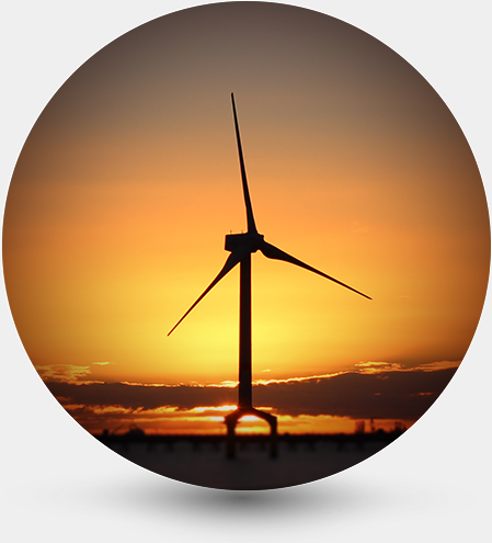
Since the German Federal Maritime and Hydrographic Agency (BSH) gave the green light for the first offshore wind farm in Germany, the VBW service spectrum has continuously shifted towards offshore engineering for the planning, installation and maintenance of offshore wind turbines and their export cables.

With a redundant portfolio of measurement technology (geophysical and geotechnical) as well as own measurement vessels, customer-specific complete or selective services are provided according to national and international standards. VBW is ISO 9001, ISO 45001 and ISO 14001 certified.

The surveying office is based in Ziesendorf and has further branch in Hamburg.

We are proud to be able to count almost all well-known participants in the industry segment “Offshore Wind” among our long-term customers.


SERVICES

The range of services includes the preparation and implementation of geophysical and geotechnical investigations in the North Sea and Baltic Sea and is rounded off by georeferenced and laboratory supported evaluations as well as expert reports according to the highest offshore standards.

ENGINEERING SURVEY

  • Creation of local basic networks
  • Stakeout and transfer of nominal geometries
  • Surveying work during construction
  • Supervision and monitoring tasks
Learn More

GEOTECHNICS

  • Site investigation of offshore wind farm areas
  • Geotechnical investigation of pipeline & cable routes
  • Geotechnical exploration of marine sediment deposits
  • Investigation of subsoil for hydraulic engineering
Learn More

GEOPHYSICS

  • Bathymetric investigations
  • Determination of sediment types and structures
  • Seismic investigations
  • Detection magnet. Anomalies, cables and pipelines
 Learn more

SHIP POSITIONING

  • Ship measurement
  • Positioning during construction (RTK)
  • Installation Documentation
  • Positioning of UW systems (USBL)
 Learn more

GIS

  • New conception of GIS projects and databases
  • Project-based off- and online GIS systems
  • Digital map and plan creation
  • Development of specially adapted user interfaces
 Learn More

CONSTRUCTION MONITORING

  • Definition and creation of construction protocols
  • Onshore and offshore construction supervision
  • Online and offline databases
  • Documentation and expertise
 Learn More

ENGINEERING SURVEY

Engineering surveying is the core area of applied geodesy and is a necessary and important task in connection with the realization of a construction project - whether in civil engineering or structural engineering, whether on land or in water.

Geotechnics

In particular for subsoil investigations of offshore wind farms and the associated cable routes, the portfolio has been expanded to include the corresponding technology and decades of geological know-how. For the core extraction of marine sediments for geotechnical laboratory investigations and lithological stratification, we have a Vibro Corer (vibratory core device) at our disposal, and a CPT for the associated mechanical parameters.

GEOPHYSICS

Our range of geophysical services has already been used in more than 80% of the wind farms in Germany's North and Baltic Sea territories that have already been approved and are currently being approved. In this regard, our clients have primarily tasked us with surveys to be conducted in line with the BSH standard "Ground Investigations for Offshore Wind Farms":

Vessel positioning

As soon as ships are used in the course of construction work, exploration of subsoil or search for explosive ordnance, the demands on positioning accuracy are significantly higher than in general shipping.

GIS Geographic Information Systems

Geographic information systems allow you to systematically organize and manage your digital geometric and factual data as well as a variety of possible spatial analyses.

CONSTRUCTION MONITORING

No construction project on land or at sea today can do without detailed and immediate documentation of the work progress and the associated logistics. Professional and continuous construction supervision is indispensable to ensure this.

Range of services

Engineering surveying describes various measurement methods and uses a wide range of measurement sensors. Especially satellite and laser technologies offer a wide range of applications within the field of engineering surveying due to the permanent updating and improvement of the systems. In the course of the erection of offshore foundations, e.g. for wind energy plants, we have made the construction-accompanying surveying on erection platforms and work ships one of our main fields of activity for several years now. We develop customized measurement concepts and equip platforms and ships with the necessary sensors.      

Areas of work

Engineering Surveying:
  • Creation of local basic networks (position and height reference / 3D)
  • Stakeout and transfer of target geometries into the field
  • Surveying work during the realisation phase
  • Supervision and monitoring tasks
  • Deformation measurements and analyses
  • Terrestrial 3D laser scanning
  • Fine levelling
  • Measurements in machine and plant construction / steel construction
  Wind turbine construction Offshore & Onshore:
  • Surveying of foundation structures during construction
  • AS BUILT Documentation of foundation structures / Quality inspections
  • Ship Positioning
 

Range of services

  • the subsoil investigation of offshore wind farm areas,
  • the geotechnical investigation of pipeline and cable routes,
  • the geotechnical exploration of marine sediment deposits for land reclamation and
  • Subsoil investigations for hydraulic engineering.
 

Areas of work

  • the subsoil investigation of offshore wind farm areas,
  • the geotechnical investigation of pipeline and cable routes,
  • the geotechnical exploration of marine sediment deposits for land reclamation and
  • Subsoil investigations for hydraulic engineering.
 

GEOPHYSICS

  • Bathymetry using single beam echo sounding or multi-beam echo sounding
  • Examining sediment types and structures using Side Scan Sonar
  • Seismic survey using boomers, as well as sub-bottom profilers or chirps
  • Investigating magnetic anomalies using magnetometers / active metal detection systems
  • Cable and pipeline detection and depth determination using 3D seismics

Areas of work

  • Bathymetry using single beam echo sounding or multi-beam echo sounding
  • Examining sediment types and structures using Side Scan Sonar
  • Seismic survey using boomers, as well as sub-bottom profilers or chirps
  • Investigating magnetic anomalies using magnetometers / active metal detection systems

Range of services

VBW Weigt GmbH uses modern technologies to position vehicles with centimeter accuracy. The location of the project area and the distance to the coast are not important. In addition to the global position, further information about the ship's position is determined in real time and displayed graphically and numerically. Each point of the ship is precisely defined with coordinates at any time. With the help of special positioning software, the ship's guidance is supplied with information about the current spatial position of your vehicle in real time. The complexity of the positioning system varies depending on the requirements and type of ship. Only tested sensors and systems are used which have proven themselves in numerous measures in tough offshore applications.

Areas of work

  • ship measurement
  • Build-accompanying positioning (RTK)
  • installation documentation
  • Positioning of UW systems (USBL)
   

Range of services

We design and operate geographical information systems for land and sea areas on a local to nationwide scale. We use recognized and compatible GisBasic systems as well as OpenSource software and our own developments and adaptations. In many years of cooperation with our clients, we have been able to successfully apply our knowledge in information acquisition, viewing, attributing and conversion with the aim of using it for specialized planning and optimization processes. Our team has extensive experience in the creation, plausibility check and maintenance of extensive DTM complexes as well as further processing to classifications, mass and volume calculations, profile and isoline generation.

Areas of work

  • New conception or continuation of GIS projects/ geo databases
  • Data research, acquisition and conversion
  • Development of specially adapted user interfaces
  • Creation of maps, map collections, off-/ online GIS systems
  • Provision in own or external data servers and web portals
     

Range of services

For the land and sea segments, we design and operate geographical information systems on a local and national scale. In so doing, we not only use approved and compatible GIS-based systems; we also utilise open-source software as well as our own developments and adaptations. We perform the following work for you:
  • Designing new concepts for or continuing with existing GIS projects and geo databases
  • Researching, procuring and converting data in various formats and coordinate systems
  • Developing specially adapted user interfaces
  • Solving complex space-related issues
  • Presenting the analysed results in a meaningful manner: -> Maps, map collections, offline or online GIS systems
  • Providing maps and data in our internal or third-party data servers and web portals
  • Our team has extensive experience in:
  • Creating, validating and maintaining extensive DGM complexes
  • Further processing to create classifications, mass and volume calculations, profiles and isolines
Together with our clients, we have been able to successfully use our knowledge to procure, view, attribute and convert information, with the aim of using it for specialised planning and optimisation processes, in long-standing collaboration.  

Areas of work

  • Definition and creation of construction protocols
  • Onshore and offshore construction supervision
  • Online and offline databases
  • Documentation and expertise
   

REFERENCES

Our range of services has already been used on more than 90% of the approved and licensed wind farm areas and associated cable routes in the German North and Baltic Seas.

Client Testimonials

  • "May I thank you for your safe working which has helped the DolWin3 project secure TenneT's safety award."

    Project Manager Cable DolWin3, TenneT TSO B.V.
  • "Thanks for the quick and uncomplicated survey execution and the immediate delivery of the survey report."

    Plant Manager - E.ON Climate & Renewables GmbH
  • „VBW is very effective partner that always rises to our challenge.”
    Operational Engineer – TenneT Offshore GmbH

Contact

Contact

Company Headquarters ZIESENDORF / ROSTOCK

Am Mühlenberg 3 18059 Ziesendorf Tel. +49 38207 9795-0 Fax +49 38207 9795-19 info@vbw-consult.com

Branch office HAMBURG

Bergstraße 28 20095 Hamburg Tel. +49 40 181585014 nl.hh@vbw-consult.com